|
Subsurface temperatures are rising in the Pacific Ocean, a signal that El Niño may be on the way, ushering in changes to U.S. weather patterns as soon as late summer. Meanwhile, a low snowpack levels is likely to stress water supplies in the West in coming months.
National Oceanic and Atmospheric Administration forecasters are projecting that La Niña will soon fade and the U.S. could begin shifting into an El Niño pattern as early as this summer, with a 1-in-3 chance it will be “strong” in late fall.
Experts say strong El Niño events tend to bring warmer weather globally and lead to more storms in the southern U.S., though those may not appear until harvest or later. In the meantime, University of California Agriculture and Natural Resources climate scientist Daniel Swain says the western and central U.S. could see a hot summer, which may challenge water access, particularly amid record-low snowpack levels across the western U.S.
“We have a pretty strong indication that for almost all of the U.S., this is likely to be a particularly hot summer to come,” Swain told Agri-Pulse.
El Niño could bring more storms to Southern U.S., but likely not until fall
El Niño and La Niña are climate patterns driven by shifting winds that redirect warm and cold water flows in the Pacific Ocean. According to the National Oceanic and Atmospheric Administration, both patterns occur every two to seven years on average, with El Niño tending to appear more frequently.
It’s easy to be “in the know” about what’s happening in Washington, D.C. Sign up for a FREE month of Agri-Pulse news! Simply click here
During El Niño, which means “Little Boy” in Spanish, trade winds weaken and warm water is pushed east toward the west coast of the Americas, causing the Pacific jet stream to "move south of its neutral position," according to a NOAA summary. This tends to make parts of the northern U.S. and Canada drier and warmer than usual, but parts of the southern U.S. to be wetter than usual and more prone to flooding.
“In general, it's something that would, especially for a strong one, maybe help alleviate drought across the southern tier of the US, which is where we have a lot of it right now,” Swain said of El Niño, though he added that that relief "won’t come probably until the latter half of the year, if not even into early 2027.”
Parts of Texas, Florida, Georgia, and Colorado are currently seeing exceptional drought, the highest classification used to gauge drought under the U.S. Drought Monitor. However, extreme drought, which falls one step below, is spread across a number of states in the West, Midwest, and Southeast.
 Brad Rippey (USDA photo)
NOAA forecasters are projecting with 55% certainty that the transition out of La Niña will occur in April, ushering in a period of neutral conditions. However, some forecasters are indicating a western ridge pattern could generate high-heat conditions across the West, though a trough pattern could keep some of that extreme heat out of the Midwest, said USDA meteorologist Brad Rippey.
Rippey said the High Plains may see conditions “on the dry side” while the Corn Belt sees wetter conditions, though he emphasized that is a “low confidence” forecast.
“Unfortunately, we are expecting a generally hot, dry summer in much of the West,” Rippey said.
However, Rippey did note there are expectations of a “decent monsoon season" and above-normal monsoon-related precipitation in parts of Arizona and New Mexico.
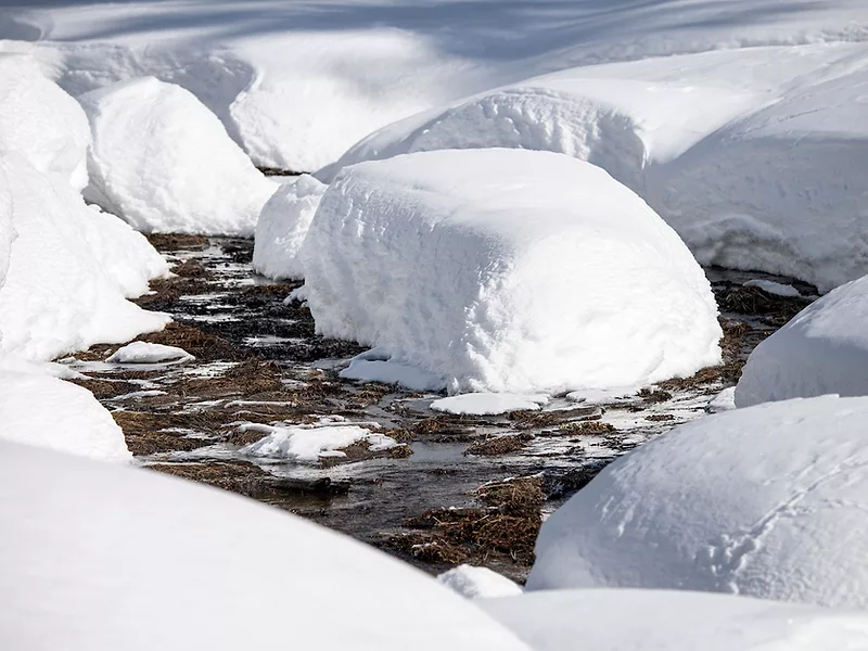
Low snowpack levels signal bleak summer for West
According to the National Integrated Drought Information System, every major river basin in the West saw its first or second warmest winter on record this year. Each is experiencing a snow drought, and agricultural water supply concerns are expected to worsen, according to an NGDIS summary. NOAA outlooks suggest a strong probability of warmer-than-normal temperatures through March.
Current levels of snow water equivalent — the amount of liquid water in snowpack — are below 50% of the median from 1991 to 2020 in California, Oregon, Nevada, Utah, Arizona, New Mexico and Colorado, according to Natural Resources Conservation Service data. While some parts of Washington, Idaho, Montana and Wyoming are seeing similarly dire conditions, others are seeing levels closer to 90% of the median.
Snow water equivalent levels in the California region are at around 23% of the median, while those in the Great Basin Region are at 34%. In the Lower Colorado River region, they are at 20% of the median, while in the Upper Colorado River they are at 44%, according to NRCS data.
“There is a really high degree of alarm regarding how poor the snowpack is, not just in one part of the West, but virtually everywhere,” said Swain. "It is worse in some places than others, but nowhere is it OK or even decent, except possibly for parts of the far northern Rockies.”
Unlike past snow droughts, Swain said this year’s isn’t necessarily a result of low precipitation, at least for some states like California. Instead, it’s being driven by “month after month of record-breaking warmth” that has melted supplies early. The state is currently seeing strong reservoir levels, though these are likely to fall without snowpack to sustain them as the year wears on.
Currently, Shasta Lake is at 89% of capacity, Trinity Lake is at 91% of capacity, and Lake Oroville is at 89% of capacity, according to the California Department of Water Resources.
“From a reservoir-only perspective, we're probably in pretty good shape,” said Cannon Michael, president and CEO of Bowles Farming Co. near Los Banos, California. “But without the snowpack behind a lot of that, it's going to be tough.”
