The latest buzzword in California water policy is Flood-MAR, or flood-managed aquifer recharge. While the approach offers a comparatively quick and cheap option for water storage, the science is complex and bureaucratic permitting processes can delay projects well into the rainy season.
Yet the extreme drought—following missed opportunities for stormwater capture in the last wet years—is mounting pressure on the state to bank more water in the ground. Water managers have been racing to get more recharge projects online ahead of the atmospheric rivers that typically start peaking in December.
To make every drop count, the state has invested in advanced imaging technologies to scan the Central Valley in search of optimal soils for recharge. The effort has brought a new understanding to how rivers and streams have shaped California’s landscape over millions of years.
“We need to harness the power of geophysical imaging,” Rosemary Knight, a Stanford University geophysics professor, told the State Board of Food and Agriculture during its November meeting. “We’re focused on finding pathways for the water.”
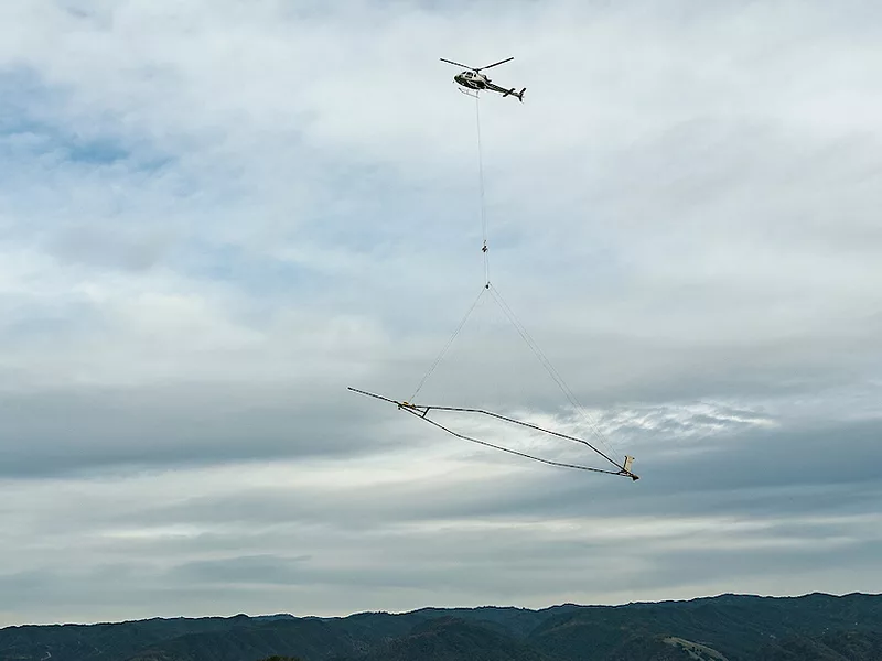
Knight is leading a project in partnership with the Department of Water Resources (DWR) and other federal and private entities to survey overdrafted groundwater basins by helicopter and by land. The Legislature approved $13 million over three years for airborne electromagnetic (AEM) surveys. Flying overheard, a helicopter dangles a massive hexagonal ring over potential recharge sites. A transmitter inside the hoop emits a magnetic field that penetrates down to about 1,000 feet below the surface, with signals pinging back to it in the same manner as a medical MRI scanner.
Knight and her team then access drilling logs to assess the type of sediment in the location and run the data through a system of equations to compute the odds for various soil types, such as sand and gravel or heavy clays.
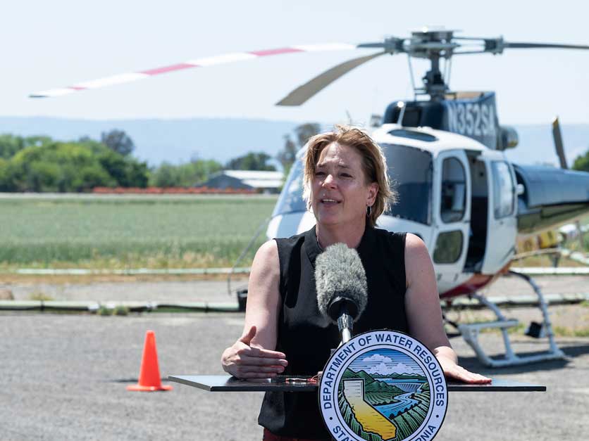 DWR Director Karla Nemeth showcases the AEM helicopter.
Board chair Don Cameron has hosted the team on his 6,000-acre farm near Fresno, where they instead towed an imaging system behind an ATV. This delivered much finer detail, though it reached a much shallower depth. Stanford pooled resources with the Tulare Irrigation District to purchase this setup for about $150,000, renting it out to any farmer eager to understand the ground beneath his or her feet.
It takes about 18 months to process the information. Knight and her colleagues at the Stanford Doerr School of Sustainability are developing open-access software to map the data, making it more understandable to water and land managers.
“The whole idea is that [our partners] are helping us design something that's going to be useful—not to researchers at other universities—but to people out there in groundwater sustainability agencies, people in nonprofits,” she said. “Let's capture those extreme storms.”
The technology offers a leg up for large-scale recharge projects as well as for growers enthusiastic about on-farm recharge (or Ag-MAR) and for floodplain restoration projects to benefit wildlife and water quality.
According to Knight, AEM surveys help to maximize the quantity and the rate of recharge. It enables districts to invest money and resources into land that is more appropriate for recharge, especially when surface water is growing scarce and valuable.
For farmers, the technology helps to avert the danger of flooding an orchard only to see the water pond up on a subsurface clay layer and weaken the root system, leading to toppled trees in the next wind event. Clay soils have also led to restoration projects seeping recharge water into surrounding agricultural fields, oversaturating the crops.
The most optimal sites contain interconnected pathways of coarse-grained sand that shunt the water directly into the aquifer. Remote sensing offers a fast, reliable and cost-effective way to find those pathways. Knight published a research paper this month in the journal Environmental Research Letters that applied AEM data to detail how underground “paleovalleys” formed during the last Ice Age offer ideal pathways.
The surveys allow water managers to tackle specific priorities for recharge, such as drawing up groundwater levels around disadvantaged communities, mitigating subsidence or developing habitat for migrating waterfowl.
The State Water Resources Control Board has been examining concerns over groundwater pumping in Northern California, where farmers and ranchers have pulled water directly from the Scott and Shasta rivers. Knight said the imaging would show this interconnection and perhaps incentivize landowners to recharge using flood flows.
Interested in more coverage and insights? Receive a free month of Agri-Pulse!
DWR has nearly completed its mapping of groundwater basins and the information is already playing a critical role with new recharge projects.
“Right now we're working on permits to get recharge projects functional by December,” said DWR Director Karla Nemeth, during a discussion at the annual water conference for the Public Policy Institute of California this month. “We learned our lesson from last year, which is that it would have been really helpful to have projects ready to capture when [the rain] is going to come.”
Nemeth said a lot of work is underway at the department for establishing criteria and issuing temporary permits, while assessing what works and what doesn’t.
“We have to start learning from doing, and we have to give ourselves permission to not do it perfectly, so that we can learn and fine tune as we go,” she said.
According to Paul Gosselin, who directs groundwater management at DWR and also presented to the board, the state has invested about $200 million so far in local assistance for groundwater recharge projects.
By the end of 2023 the total funding will jump to $350 million. Local agencies have proposed more than 340 new recharge projects, which would result in as much as 2.2 million acre-feet of additional storage in a single wet year by the time the projects are completed in 2030, according to the Newsom administration.
In August the administration released a water supply strategy that sets a goal of expanding the amount of water recharged into aquifers by 500,000 acre-feet each year. Gosselin estimated California contains as much as 4 million acre-feet of capacity for recharge.
For more news, go to www.Agri-Pulse.com.
