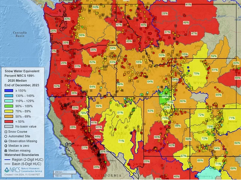
Snowpack conditions are among the lowest levels ever recorded at many measuring stations in the Natural Resources Conservation Service Snow Telemetry (SNOTEL) Network.
According to NRCS, Western SNOTEL stations Pacific Northwest precipitation was above normal in much of December, but “abnormally high temperatures for the same period” resulted “in little snowpack accumulation.”
It’s easy to be “in the know” about agriculture news from coast to coast! Sign up for a FREE month of Agri-Pulse news. Simply click here.
“In other areas across the West, dry December conditions mostly prevailed and, along with warm temperatures, set the stage for record or near-record low snowpack in many locations at the start of the new year,” NRCS said in a recent report.
Federal forecasts are projecting heavy precipitation for the central and northern Pacific coast in the near future, including “high probabilities found in the intermountain West,” and temperature changes could aid in recovering snowpack.
“There is an increased probability of below-normal temperatures west of the Rockies, particularly in the southwest,” the most recent National Drought Summary reported.
For more news, go to Agri-Pulse.com.
