California is drying out after an unprecedented series of winter storms brought weeks of rain, flooding, high winds, blizzards, weeklong power outages and at least two tornadoes.
The state, which was still struggling just weeks ago under a deep multi-year drought, was hit with nine atmospheric rivers, which can each carry as much precipitation as a hurricane.
Fortunately for farmers, most crops hadn’t been planted yet in the areas of the Central Coast and northern San Joaquin Valley that were hit hardest. While water supplies are shaping up well for the coming growing season, it’s not clear yet how much the floodwaters will help recharge badly depleted groundwater sources.
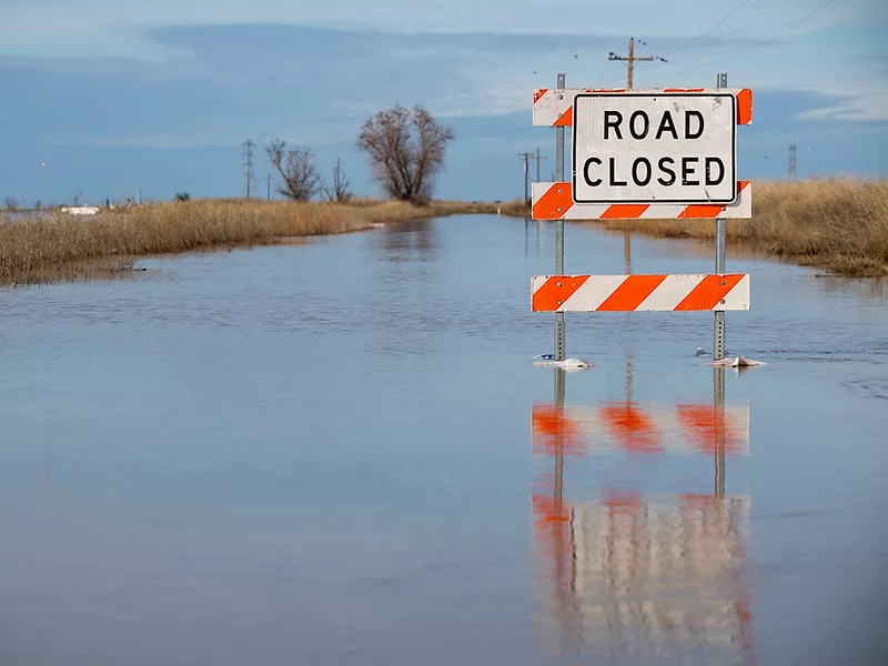
The first storm landed on New Year’s Eve and led to breached levees in farmland about 20 miles south of the state capitol. A few ranchers scrambled to evacuate livestock as floodwaters rose, while others watched as horses waded through water deep enough to submerge cars. Winds exceeded 70 mph in Sacramento County, toppling large oak trees onto a walnut orchard at one farm, according to the California Farm Bureau.
A separate levee breach forced the evacuation of a small farmworker community further south in Merced County. Gov. Gavin Newsom visited the county last week and pledged to “future proof” the region from climate impacts.
After two weeks of rain, the soil was saturated and smaller storm systems led to devastating floods in coastal regions that grow lettuce and berries, including the Salinas and Pajaro valleys and Santa Barbara County. Monterey County Farm Bureau Executive Director Norm Groot told Agri-Pulse about 20,000 acres of farmland in his county are flooded or have standing water due to the Salinas River overtopping its banks, with up to $50 million in damages to crops and farm infrastructure. The county has submitted a request for a federal disaster declaration.
Last week the storms shifted to the northern end of the state, raising the state’s largest reservoirs. Rivers in Wine Country hit flood stage in a region that went critically dry two years ago.
 Monterey County Farm Bureau Director Norm Groot
At least 20 lives have been lost in the storms and communities have suffered more than $1 billion in damages to property, roads and other infrastructure. The White House approved a major disaster declaration on Saturday, providing assistance with emergency response and housing support for flooded counties. More than 30 of California’s 58 counties are now included under disaster declarations.
President Joe Biden will travel to California on Thursday to visit areas devastated by winter storms. The White House said Monday the president plans to tour the Central Coast and meet with state and local officials to survey recovery efforts and coordinate federal support.
California’s farmers and ranchers have suddenly found themselves under emergency declarations for both the drought and flooding. The $50 billion agricultural economy largely relies on a complex system of more than a thousand miles of canals and about 1,500 reservoirs to store rain and spring snowmelt to deliver throughout the dry summer months for irrigation. After three years of intense drought and extreme heat waves, however, the reservoirs were so low that state officials were only releasing enough to satisfy basic human health and safety needs for the cities and towns dependent on imported water.
Lake Shasta, the state’s largest reservoir, stood at about 30% of capacity before the storms arrived and has since nudged up to more than 50%, though it remains below average for this time of year. The water level in Lake Oroville, the second largest reservoir, fell so low last year that dam operators had to shut off power generation. It now stands slightly above average for this date.
Reservoir levels only tell part of the story when it comes to the water outlook for growers this year. California’s mountains store the largest amount of water, in the form of snow. The overall snowpack for the state now sits at more than 250% of average for this time of year, with more snow on the way Wednesday night.
Most reservoirs still have plenty of room for capturing more runoff from rivers and streams, but a few have been releasing enormous amounts of water. To protect Sacramento from floods, the U.S. Bureau of Reclamation must keep Folsom Lake about half empty at this time of year in preparation for any future storms.
High reservoir releases from Folsom and other dams have combined with natural runoff funneling into the Sacramento-San Joaquin Delta and eventually into the ocean. Massive pumps are delivering about 2% of the floodwater to farms, cities and reservoirs in the San Joaquin Valley and Southern California. Many growers along the canals have been diverting floodwater onto their farms to percolate into the groundwater aquifers, serving as a savings bank for the next dry times. Farms that went fallow months ago are now under water.
Interested in more coverage and insights? Receive a free month of Agri-Pulse by clicking on our link!
Meanwhile, state agencies have been racing to approve permits for new groundwater recharge projects to capture flood flows at a larger scale.
During the 2012-16 drought, many communities turned to groundwater pumping to supplant surface water supplies, and an epidemic of drinking water wells running dry led lawmakers to pass a series of bills known as the Sustainable Groundwater Management Act in 2014. Researchers estimate that curtailing groundwater pumping over the 20-year timeline will require fallowing a fifth of the San Joaquin Valley’s farmland unless the state finds new ways to capture more water.
The first plans under the new regulations began taking effect in 2020, and many of those rely on capturing floodwater to recharge aquifers. State hydrologists estimate California has far more capacity for underground storage than it does in the existing reservoirs.
But the state has long been mired in political debates over protecting endangered fish populations in the Delta and river watersheds. Proposals for building new reservoirs have stalled and restrictions on pumping water to protect fish have slowed water deliveries and frustrated farmers, while permitting remains an obstacle for groundwater recharge projects as well.
For now, the storms have largely reversed the deep drought in which the state had been. Just three months ago, 40% of the state was rated in extreme or exceptional drought; now none of the state is, according to the U.S. Drought Monitor map.
Still, climatologists are cautioning the situation could quickly change in the months ahead. Over the last two years, parched ecosystems have absorbed more runoff, while spring heat waves have evaporated portions of the snowpack directly into the atmosphere before it could melt.
For more news, go to Agri-Pulse.com.
